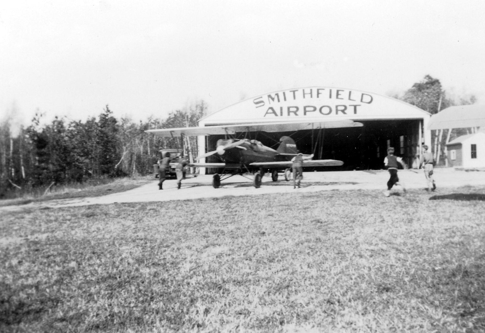
Travel Air 2000 Aircraft – 1937
Taken by Louis C. McGowan at the former Smithfield, R.I., Airport in 1937.

Travel Air 2000
Smithfield, R.I., Airport
1937
from author and historian Jim Ignasher
Travel Air 2000 Aircraft – 1937
Taken by Louis C. McGowan at the former Smithfield, R.I., Airport in 1937.
Travel Air 2000
Smithfield, R.I., Airport
1937
ARTHUR GOULD’S VISION OF THE FUTURE
Originally published in Your Smithfield Magazine, February – 2013
 There was a time when the sound of an airplane motor buzzing overhead automatically caused one to look skyward, and Arthur Gould did just that whenever one passed over his farm on Ridge Road. Not only would he study the aircraft for signs of needed repairs, but he would listen for indications the engine might be in need of fixing, or perhaps was low on fuel. His hopes rose one afternoon when a small plane circled several times at low altitude as if it might land, but disappointment set in when it veered away.
“Well,’ Gould likely thought, ‘Maybe he didn’t need anything today, but now that he knows I’m here, perhaps he’ll be back.”
Sometimes it takes awhile for an idea to catch on. At the dawn of the 20th Century, there were some who felt the automobile was nothing more than a passing fad for rich people, but Henry Ford predicted a time when it would become an indispensable means of travel. When the Wright brothers flew the first airplane in 1903, few saw its practical applications, but the brothers believed a day would come when airplanes would travel sixty-miles per hour! Where would we be today if not for forward thinkers?
Arthur C. Gould of Smithfield was a forward thinker who possessed an entrepreneurial spirit. Born in 1865, he was a successful farmer, blacksmith, and wood worker; owned a prosperous ice business, and even dabbled in real estate. However, of all his economic ventures, the most innovative was his idea to open a business called “Flyers Haven” in August of 1926.
Flyers Haven was an “aircraft repair and service station”; perhaps the first and only business of its kind in New England; or at least in Rhode Island. Basically, it was a place for passing airplanes to land for fuel or repairs much like a service station for automobiles. Gould wasn’t trying to establish an airport, just a place for aircraft to make a quick stop if need be.
It was a novel idea for the time for the airplane was still relatively new, but Gould envisioned a day when they would dot the skies, and establishments such as his would be a welcome sight for those low on fuel much like a gas station along a highway is for a motorist.
The 1920s was an exciting decade for aviation development. Newspapers constantly ran stories of aircraft altitude, speed, and distance records being set and broken. It was also the era of a new breed of pilots known as “Barnstormers”; mostly ex World War I military pilots who found themselves out of work, and missing the action when war ended. They would travel the countryside giving daring aerial exhibitions and offer rides to those willing to pay. It was also a time when the first commercial airlines were being developed, and an international race was on to see who would be the first to fly non-stop across the Atlantic.
Yet just because they flew, didn’t mean that airplanes were any more mechanically reliable than the automobiles of the day. Although configured differently, both car and aircraft utilized oil-dripping, temperamental engines that required frequent maintenance and adjustments. Gould knew first-hand about automobiles, for many years earlier he owned what he claimed to be the first car in Smithfield; a one cylinder Knox, produced by the long defunct Knox Automobile Company of Springfield, Massachusetts. The Knox engine was dubbed the “porcupine” or “hedgehog” by many mechanics due to the many wires and other projections poking out of it. While owning the only car in town, Gould discovered that it was difficult for a motorist who found himself stranded to locate things like gasoline and tires. Recalling his experiences, he considered what it must be like for a modern aviator.
Thus an idea was born as Gould realized that airplanes, like cars, needed to re-fuel and be repaired. An automobile with mechanical trouble could just coast to a stop at the side of the road, but the problem for an aviator in trouble was finding a safe place to land. In the 1920s, airports, or more accurately, airfields, were few and far between, leaving many pilots to their own devices when it came to emergency landings. Grassy fields could conceal hidden hazards such as logs, holes, or barbed wire fences, and landing on a tree lined road, or worse, one lined with telephone poles, carried even more risks. Even if the pilot negotiated a safe landing, there was the formidable task of locating the high octane gas necessary for flight. What Gould offered the troubled flyer was a full-service safe-haven.
Opening such a business required lots of elbow room, and Gould had it on his twenty-seven acre farm located between Douglas Pike and Ridge Road, behind present-day La Perche Elementary School. The site was relatively flat and open. It already had had an ice pond that could accommodate seaplane landings, and a barn that contained a blacksmith forge, a machine shop, and a wood-working shop. All he needed to do was install a tank for aviation fuel.
To let passing airplanes know that he was open for business, Gould painted a large sign on the roof of his ice house that read, “Airplanes welcome to my farm, A.C. Gould”. Although the letters were three feet tall, Gould realized they might be hard to read from high altitudes, so he created even larger signs in his meadow using white lime. In lettering that was fifteen feet long Gould wrote, “A.C. Gould Farm Landing Field”, and “Aviation Gas”. He also laid out a four-hundred foot long compass that pointed due north to aid any pilots who were just looking for directions.
Gould received further advertising when a reporter from the Providence Journal went to his farm to interview him about his new enterprise. He hadn’t had any customers as of yet, but he remained hopeful as he recalled the small plane which had circled his farm several times at a low altitude before flying off. It was his hope that the pilot would tell others, who would then mark the location on their Department of Commerce maps.
Flyer’s Haven was not an airport, nor was it meant to be. It was simply a place for a pilot to stop, re-fuel, check the oil, and be on his way. Gould’s idea was a good one, and unique enough to be written about in the New York Times, but it seems he didn’t make much money from it. Perhaps as a man who looked towards the future, he was just a little too ahead of his time. He passed away less that three years later on March 12, 1929 at the age of 63.
A History of the Smithfield, Rhode Island, Airport
Click on images to enlarge.
The Smithfield Airport was established in 1932 by John Emin Sr. Emin had purchased a Curtis Pusher aircraft which he kept at What Cheer Airport in Pawtucket. One day he learned of an airplane hangar for sale in nearby Massachusetts and bought it. He had it disassembled and brought to his farm on John Mowry Road in Smithfield. After reassembly, he cleared a corn field to be used for takeoffs and landings.
This airport was located where Bryant University stands today and should not be confused with the North Central Airport presently located in Smithfield on the Lincoln town line.
On May 28, 1934, the airport saw its first fatal accident. For more information, click here.
Other crashes that occurred at the airport include:
September 19, 1935
June 22, 1937
January 10, 1942
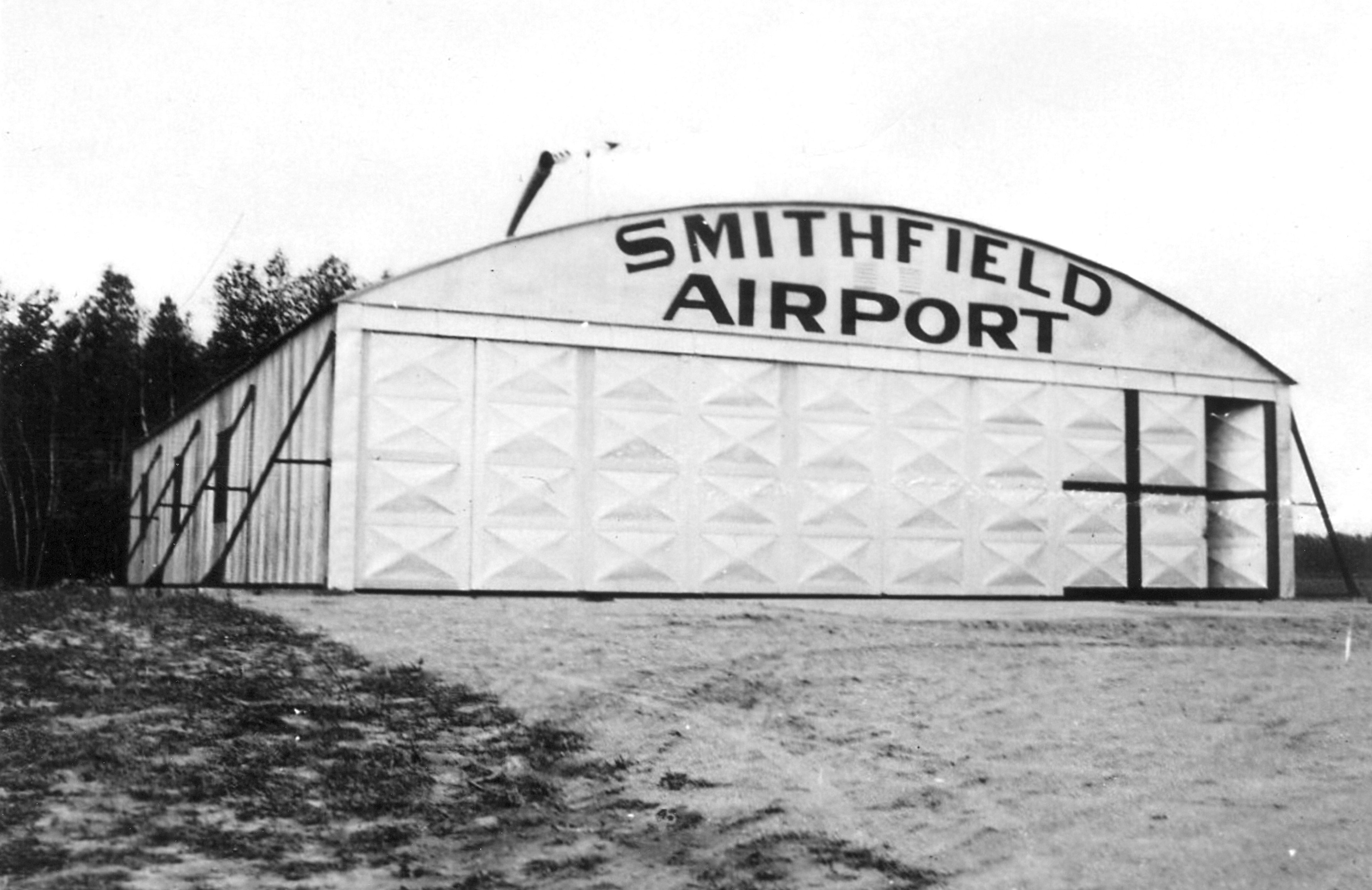

Smithfield Airport Hangar – Unknown Date
Courtesy Louis McGowan
Johnston, R.I. Historical Society
On May 19, 1938, during National Airmail Week, several planes carried airmail away from the Smithfield Airport. Mrs. Ellen Russell, the postmaster for Georgiaville, cancelled envelopes with a special stamp.
On February 1, 1941, it was announced that the Smithfield Airport might be developed into a secondary civil airport comparable to Hillsgrove Airport in Warwick. The primary reason was to establish a major airport that could service northern Rhode Island and nearby Massachusetts. There was also the prospect of getting involved in the war raging overseas in Europe. If that happened, Hillsgrove was to become a military airfield.
History has shown that the United states did enter the war (World War II) on December 7, 1941.
Plans for developing the Smithfield Airport moved swiftly at first, with proposals to relocate the hangar and build longer runways. However, these proposals never materialized.
In July of 1941 the Nelson Aircraft School was established at the Smithfield Airport.
On October 5, 1941, what was described as a “spectacular air meet” was performed at the airport. Over 15,000 people attended and vehicle traffic overwhelmed the back roads and two-lane Douglas Pike leading to the airport. Local and state police had a difficult time dealing with the blocked roadways and stand-still traffic.
One event at the air meet included a parachute jump from 3,000 feet. Arthur Daigle, the parachutist from Norwood, Massachusetts, was carried off by the wind and landed in a wooded area outside the airport. He wasn’t injured.
The United States entered WWII on December 7, 1941. By April of 1942, the U. S. Army had taken over Hillsgrove Airport for use as an army air field, and all civilian aircraft were ordered removed. Some of those aircraft ended up in Smithfield where they were staked to the ground as there wasn’t enough room in the airport hangar. It was reported that thirty planes were intitially brought to Smithfield, and a few more followed over the next few days.
By August of 1942, the U. S. Army banned all civilian aircraft from flying in the “Eastern Seacoast Zone” which included all of Rhode Island. Plane owners were given short notice of the ban, and some opted to take their aircraft further inland to western Massachusetts where the ban did not apply. Those who failed to do so were forced to keep their airplanes in Smithfield for the duration of the ban, which wouldn’t be lifted until August of 1945.
In October of 1945, Smithfield’s first post-war air show was scheduled to be held at the airport, but had to be postponed twice due to bad weather. The event was finally held at the end of November.

The Attleboro Sun
July 2, 1949
A WWII FOOTNOTE TO HISTORY
How a chance meeting affected the outcome of World War II
The original hangar at the Smithfield R.I. Airport which opened in 1932. Bryant University now occupies this land.
Photo courtesy of John Emin Jr.
Like the ripples caused by a pebble tossed into a still pond, sometimes a minor event can have far reaching effects. Take for example a boy in Pennsylvania who yearned to be a pilot; or the young man in Rhode Island with a passion for flying who decided to build an airport. The decision made by each would touch the life of the other, and ultimately play a role in the outcome of the Second World War.
This story is true, but it’s virtually unknown beyond the borders of Smithfield, Rhode Island, and therefore won’t be found in any history books about the war. It might never have come to light had it not been for cards and letters saved by John and Marjorie Emin; owners of a farm once located where Bryant University stands today.
John was a pilot, and like most pilots, he wanted to own an airplane. In July of 1931 he purchased a two-seater Curtis Pusher aircraft which he kept at What Cheer Airport in Pawtucket about twelve miles from his farm. Twelve miles may not seem like much of a distance today, but automobiles and roads in those days made getting from Smithfield to Pawtucket a bit of an effort. Therefore, John fancied the idea of an airport closer to home.
The following year while on a visit to Massachusetts, Emin happened upon an airplane hangar for sale and bought it. It was dismantled and brought to his farm where he reassembled it himself. When he was finished he painted “Smithfield Airport” across the front in large letters. After clearing a nearby cornfield for use as a runway, Smithfield had its first airport. (The Bryant University football stadium now occupies the area were airplanes once landed, and a maintenance building has replaced the original hangar.)
In December of 1932, William G. Benn of Coudersport, Pennsylvania, was a 2nd Lieutenant with the103rd Observation Squadron of the Pennsylvania National Guard. Three days before Christmas that year he and his observer, Private John G. Mallon, left Boston for Philadelphia in a Douglas O-38, bi-plane.
The weather of course was cold, as is typical for New England in December. Snow flurries were already falling as the plane lifted into an overcast sky, and within an hour the flurries turned to snow. As winter winds buffeted the plane, ice began forming on the wings causing a loss in airspeed and altitude. Before long, Benn was struggling to keep his ship in the air.
The men knew they were in trouble, but finding a place to set down presented a problem, for the plane lacked a radio and they were over unfamiliar countryside. Checking a Department of Commerce map, Mallon discovered that the nearest airport was already several miles behind them in Woonsocket, Rhode Island. (The Woonsocket Airport no longer exists.) By this time the plane was barely one-hundred feet in the air and in danger of stalling for lack of airspeed. With no other choice, Benn took a heading for Woonsocket, when suddenly below them appeared a small airport that wasn’t on their map for it had only opened a few weeks earlier. Thanking God for their deliverance, Benn set the plane down on the snowy field and coasted to a stop. The name on the hangar told him they had landed at the “Smithfield Airport”, but neither of the airmen had any idea where Smithfield was.
As Benn and Mallon climbed from their airplane they were met by John Emin who had seen their emergency landing from his farmhouse. (The farmhouse stood where the dome of Bryant’s “Unistructure” is located today.) After brief introductions, Benn asked to use a telephone to notify his superiors that he had landed safely and hadn’t crashed in the storm, but John explained that he didn’t have one. The nearest phone was at a general store about a mile down the road in the village of Stillwater, and John graciously allowed the airmen the use of his car to get to it.
In March of 1935, Benn published his recollections of this day in an article he wrote for the Pennsylvania Guardsman, in which he described the store in Stillwater as “the original country store”, with a pot-bellied stove in the center and shelves lined with tobacco, groceries, shoes, clothing, toys, and “notions”. Benn described how he and Mallon ate bananas while waiting for their call to be put through, and noted the attention they were getting from several card-playing locals who stopped their game long enough to give them a thorough once-over while a dog stood at their feet begging for a handout.
When their business was complete, they returned to the airport where John and Marjorie invited them to stay until the weather cleared. The flyers graciously accepted, but having lived in a large city like Philadelphia, they were surprised to learn that country living meant doing without certain “luxuries” such as indoor plumbing and electric lights. In his article Benn recalled how they spent an enjoyable evening with their hosts and slept soundly in an antique featherbed. The following day the weather in Rhode Island had cleared enough where they decided to try for home.
The young men didn’t forget the kindness shown to them and wrote thank you notes. These letters and other correspondence have survived, and are still in the possession of the Emin family.
In his letter Lieutenant Benn wrote:
Dear John and Margy:
May this note of appreciation find you snugly returned from a very Merry Christmas in New Bedford.
The trip down to Philadelphia was none too pleasant. The snow lasted down to New Haven with haze and mist from there into this city. Landed here at 2 in the afternoon so it did not take very long. Found that all of this area was closed in with clouds and rain Saturday so am all the more glad that we were honored by your hospitality.
Would like to have put on a little more show for you but trust that you will believe me when I say that it takes but a small amount of ice formation on a wingfoil to change the flying characteristics of the airplane. She flew right wing heavy all the way down to Trenton where the warm air into which we were flying, melted most of the ice away.
Might call to your attention the fact that upon landing, we asked if they had any trouble in finding Smithfield. The answer was no because they had a late edition of the Department of Commerce map of that area and that it was well marked. I trust that you will not be swamped with transient pilots who, after hearing of our wonderful experience with you, would like to duplicate. We both wish to assure you that we had a most enjoyable time and were truthfully reluctant to depart.
We thank you sincerely and hope that we may have the good fortune to call upon you again.
With every best wish for the New Year, truly,
W.G. Benn
2nd Lt. A.C. (P.N.G.)
Private Mallon related in part, “I have related the experience to many other people over the holiday and all agree what a delightful couple we must have visited.”
What followed was a pen-pal relationship between the Emin’s and William Benn that lasted into World War II.
Benn sent the Emin’s a copy of the Pennsylvania Guardsman magazine containing the story of his unexpected visit, along with a letter describing how his mother liked the informal account he had sent to her, rather than the formal version that appeared in print. To this Benn wrote: “But after all, I do not pretend to be any sort of writer – to the contrary, just a good pilot, and to that end, my story is going to remain. However, I did so hope that some others would have the pleasure of enjoying our trip with us. I believe that many of the boys have and therein, the purpose fulfilled.
Benn had taken courses in archeology hoping for a career in that field of science, but by the late 1930s it seemed apparent that the United States would be drawn into war so he elected to stay in the military. All the while he kept up his correspondence with the Emin’s through cards and letters. In March of 1941 Benn wrote that he and his wife Dorothy were the proud parents of a daughter, Bonnie. The following Christmas the United States was at war.
The Emin’s mailed Benn a Christmas card that season of 1941, but he waited nearly four months to respond. It’s understandable due to what was going on at the time for all military personnel.
In his letter dated April 26, 1942, he wrote in part:
“Christmas & New Years wasn’t much – constant alert, and probably will not be much for several years to come. In the meantime, many are the times that I reflect back to Pennsylvania & New England – to places & people like you – to things done and odd experiences, people met and liked. It is true enjoyment in a busy life.”
At the time Benn wrote that letter he was assigned to the U.S. 4th Air Force, commanded by General George Kenney, based in San Francisco, California. Kenney had been in the army since World War I, and was held in high regard for his innovative ideas in the use of aircraft serving in combat roles. In the spring of 1942 he took command of the 5th Air Force which was ordered to Australia to fight the Japanese. He brought with him fifty hand-picked pilots who had served under him in the 4th Air Force, one of them being William Benn, who was assigned as the General’s aide.
Part of the mission of the 5th Air Force was to support allied ground troops and attack Japanese supply ships re-enforcing enemy positions. The initial strategy had been to use high altitude bombers to bomb enemy ships, but bombing from high altitudes allowed targets ample time to scatter and avoid being hit. The obvious answer was to conduct the bombing at lower altitudes, but this carried higher risks for the aircrews, and early in the war the United States didn’t have the airplanes to spare.
William Benn, who by this time had been promoted to Major, pondered the problem and came up with the idea to attack the enemy ships from the side rather than from above. In August of 1942, he went to General Kenney with an idea he called “skip bombing”. Benn proposed using conventional bombs which could be “skipped” across the water like a stone across a pond into the side of a ship. The bombs would be equipped with delayed fuses to give them a few seconds to sink below the hull waterline before exploding, thereby producing maximum damage.
The plan of attack was to send in two groups of high-level bombers as a diversion to attract enemy anti-aircraft fire, while a third group would come in low, about 300 feet above the water’s surface, and release their bombs.
The idea was simple enough in theory, and Kenney was intrigued with its possibilities. Benn was given command of the 43rd Bombing Group with authorization to develop and perfect the technique. Testing began at Port Moresby, Australia, in September of 1942, where B-25 Mitchell bombers made trial runs at the hulk of an old barge. (The B-25 was a twin-engine light bomber used by the allies throughout the war.)

B-25 Mitchel bomber
USAF Museum photo
One obstacle to overcome was the fact that conventional bombsights were designed for dropping bombs from high altitudes, not low-level attack runs. Benn solved this problem by making cross hairs out of electrical tape on the Plexiglass nose of the aircraft where the bombardier sat, thus using the plane itself to aim the bomb.
By the autumn of 1942, Benn’s squadron was ready to try his skip bombing technique in actual combat. On October 22nd, Benn led a night mission against Japanese ships at Rabual with limited success. Although some vessels were hit, none were actually sunk. A second raid was conducted on October 30th with similar results.
Even though initial success was limited, Major Benn had proven the idea had merit and set the course for others to follow. Major Paul Gunn later expanded on Benn’s idea by using modified B-25s equipped with forward firing guns with good results.
Prior to the implementation of skip bombing, the allied success rate for bombing enemy shipping in the Pacific was less than five percent, but with skip bombing the success rate rose to over seventy percent. This no doubt changed the course of battles, saved American lives, and helped shorten the war. For his efforts Major Benn was awarded the Distinguished Service Cross, an award second only to the Medal of Honor.
Benn’s success attracted the attention of Time Magazine, which featured him in an article about skip bombing that appeared in the January 18, 1943 issue. The article mentioned that Benn’s skip bombing technique was now the standard mode of attack used by General Kenney’s 5th Air Force. Unfortunately, Benn never saw the article, for on the day the magazine hit the newsstands, he took off from Jackson’s Drome airstrip on what was to be a routine reconnaissance mission and disappeared.
The aircraft he was piloting was a B-25 Mitchell bomber with tail number 41-12485. There were six others aboard the lone aircraft when it vanished; Major Donn Young, Lt. Col. Dan Searcy, Sgt. Wilfred Coyer, Sgt. Herman Elsner, Cpl. LaVerne Van Dyke, and S/Sgt. Michael Ewas.
No distress calls were ever received, and it was surmised that whatever happened had been sudden and quick. Search planes flew along the missing B-25’s estimated route, but found nothing. Speculation as to what happened was brief. There was a war on, and planes and men were lost everyday.
Back in Smithfield, John and Marjorie Emin wondered why their friend Bill had stopped writing, and hoped it was because he was too busy. Then the day came when a newspaper clipping arrived in the mail stating that Benn was missing. Naturally they prayed for the best, but they never learned anything more.
On March 2, 1943, what became known as the Battle of the Bismarck Sea began in the Pacific. The Japanese had sent sixteen warships to reinforce their troops in New Guinea, and the 5th Air Force was charged with stopping them. The battle raged for two days, during which the Allies used Benn’s skip bombing technique against enemy ships. When it was over the Japanese were the clear losers, and as a result, this was the last time they attempted to use large vessels to reinforce their positions. Even though he wasn’t there to see it, Major Benn’s skip bombing technique was credited for the American victory.
World War II ended in August of 1945, and the troops went home to resume their lives. Those who had been lost faded into the recesses of history, remembered primarily by those they left behind. John and Marjorie Emin passed away without ever learning the fate of William Benn.
Benn’s aircraft was just one of thousands declared “missing” during the war, however the mystery of what happened to him was solved in 1957 when an Australian survey team happened upon the wreckage of a World War II aircraft in a wooded valley in New Guinea. The tail numbers matched those of Major Benn’s long lost B-25. U.S. authorities were notified, and the remains of the servicemen were recovered.
Investigators determined that the aircraft had not gone down due to hostile action, but had most likely entered fog when it flew into the valley, and the crew never saw the mountain looming ahead. Death had been instantaneous.
One has to wonder if history would be different if John Emin hadn’t built his airport. Would Bill Benn have made it to Woonsocket? If he hadn’t survived, would someone else have developed the skip bombing technique? The world will never know, but it can be argued that because Bill Benn found safe haven that long ago Christmas many allied troops survived the war and were able to go home to live out the rest of their lives in peace.
New England Air Fields As Of 1934
The following information was gathered from a publication distributed by the Unites States Department of Commerce – Bureau of Air Commerce, titled, “Descriptions of Airports and Landing Fields in the Unites States”, Airway Bulletin #2, dated September 1, 1934. Some of the air fields listed here are still in operation, others are not. It’s possible that this list is not complete.
CONNECTICUT

Linen Post Card Brainard Field, Connecticut
Bridgeport – Mollison Airport, commercial. Located 3 mi. SE of Bridgeport, and 1.5 miles S of Stratford. Altitude 10 ft. Two gravel runways, 2,800 ft. N/S, and 2,600 ft. E/W. Remainder of field not developed. Hangars and buildings to the north. “Bridgeport Airport” on hangar roof. 24 inch rotating beacon. 24-hour facilities for servicing aircraft. Seaplane anchorage and service facilities on Housatonic River adjacent to airport. Airport was dedicated July 5-6, 1929
Bristol – Stephenson Field, commercial. Located 1.5 miles SE of city. Altitude 240 ft. 30 acres. Two runways measuring 1,475, and 1,380 feet. Hangar, minor repairs, aviation fuel, day only.
Canaan – Canaan Airport, municipal. Located 1.25 miles north of Canaan on Federal Route No. 7. Altitude 690-699 feet. Three runways, each measuring 1,700, 2,400, and 2,000 feet. Hangar and office building. Aviation fuel, days only.
Danbury – Danbury Airport, municipal. 2 miles SW of Danbury center. Altitude 440 feet. Two runways, measuring 1,950 and 1,600 feet. Hangar building, repairs, fuel, days only.
Essex – Doane Airport, commercial. Located 1.4 miles west of Essex. Altitude, 15, feet. “Essex” embedded on field. Aircraft service facilities – day only.
Groton – Trumbull Field, state owned. Located three miles south-east of New London. Three runways, measuring 1,500, 1,400, and 1,000 feet. 24-inch rotating beacon, clear, with clear auxiliary code flashing “G”, (- – .) 24-hour aircraft service facilities. Seaplane base with natural hard sand beach and ramp to the south-east.
Hamden – Hamden Airport, commercial. Located within city limits, one block east of Dixwell Avenue. Altitude, 50 feet. “Hamden Airport” on hangar. Hangar and repair shop on south side of field, Aircraft service facilities – day only.
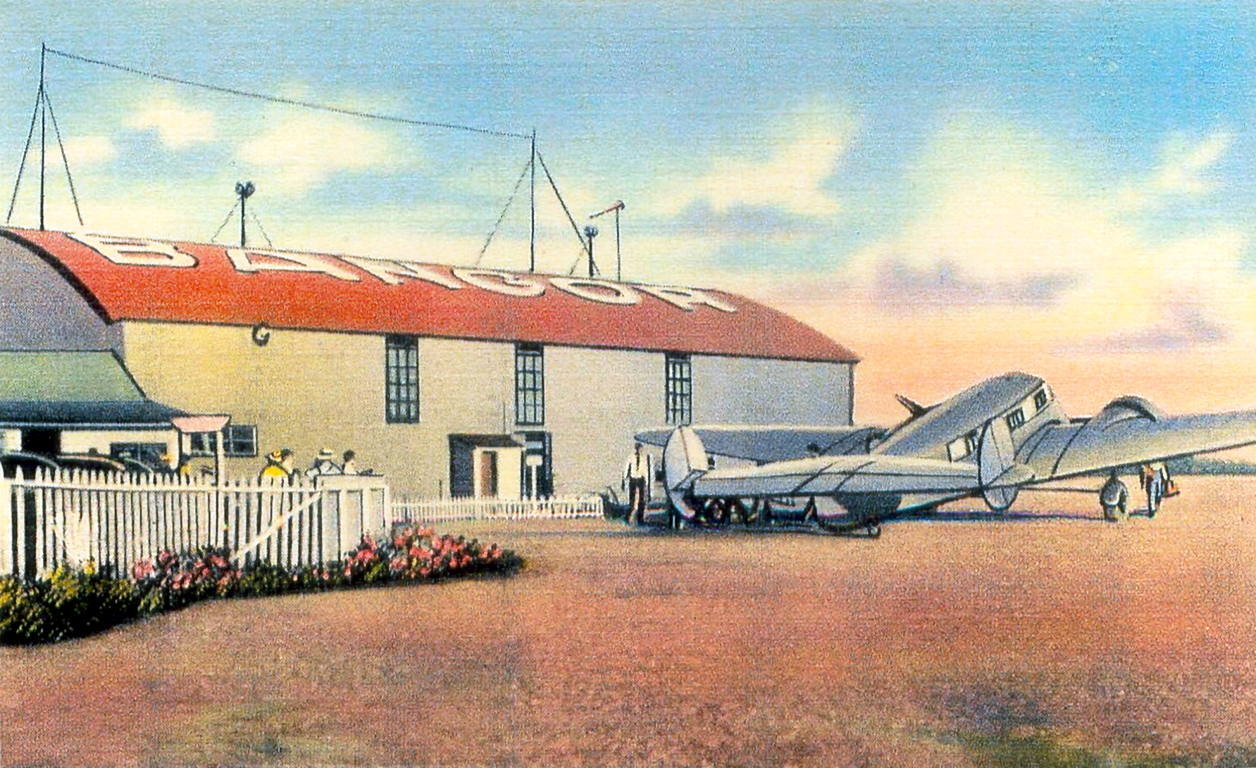
Hartford – Brainard Field, municipal. Located within city limits, borders west bank of Connecticut River. Altitude, 26 feet. Three runways, two measuring 3,600, feet, and the third measuring 2,800 feet. “Hartford” on hangar roof and embedded in field. 24-hours aircraft service facilities. This airport is used as the operational base for the Connecticut National Guard. Low powered radio station, WWIC, for point to point and communication with aircraft, operating frequency, 278 kc. 24-inch green rotating beacon that flashes “H”, (. . . . ).
Madison – Griswold Airport, commercial. Located one mile NE of city. Altitude, 20 ft. Sod field. Two runways, measuring 1,800, and 1,400 feet. Hangar and aviation fuel, days only.
Meriden – Meriden Airport, municipal. Located 2.5 miles SW of city, just south of a large pond; .5 mile east of large reservoir. Altitude 74 feet. One landing strip, 3,500 feet long. Buildings in NE corner of field. “Meriden” on hangar roof. Lighted beacon, green, flashing characteristic “U” (..-). 24 hr. facilities for service.
New Canaan – Moller Airport, auxiliary. Located 1.5 miles south of New Canaan, monastery 1 mile south, Altitude, 200 ft. Two runways, 1,800 feet long. No service facilities.

Early Post Card View Of New Haven Airport
New Haven – New Haven Airport, municipal. Located 3.5 miles south-east of city. Altitude, 4 feet. “New Haven” embedded in field. Buildings and beacon tower, and landing area flood lights. Beacon showing green, flashing code (-., …) on Administration building. Beacons operated from sunset to sunrise. Boundary and obstruction lights kept burning every night from sunset to 9:30 p.m., but could be turned on by watchman at any time upon advance notice or circling the field. 24-hour facilities for serving aircraft. Airport equipped with teletypewriter. Airport was dedicated August 29, 1931.
New Haven – New Haven Seaplane Base, commercial. Located in New Haven Harbor, north of Sandy Point. Landing area 2,640 feet except at low tide. “West Haven” on hangar. Ramp facilities. Aviation fuel and repairs, days only.
Niantic – State Camp Field, owned by the sate. Located immediately north of Niantic on west bank of the Niantic River, 6 miles south-west of New London. Altitude, 6 feet. Beacon, clear flashing, operating during the summer months only. No servicing facilities.
Norwalk – Norwalk Airport, auxiliary. Located 1 mile north of center of city of West Rocks Road. Altitude, 400 feet. One runway, 1,400 feet. “Norwalk Airport” on hangar. Facilities for servicing aircraft – day only.
Putnam – Dept. of Commerce intermediate field, site 14B New York-Boston Airways. Located 1.5 miles south-west of Putnam. Altitude, 455 feet. Two runways, 2,200 and 1,950 feet. Power shed marked “14 NY-B”. Two acetylene blinkers flashing green at ends of runway. No servicing facilities. Marker beacon, nondirective indentifying signal “S” (…) operating frequency 266 kcs. Airport had a Teletypewriter.
Torrington – Cary Field, municipal. Located 3 miles north-east of city, .4 mile south of steepled church; .5 mile north of four-strip concrete highway. Altitude 1,040 feet. Three landing strips measuring 1,000, 1,500, and 1,600 feet. “Torrington” on hangar roof. Service facilities – days only.
Wallingford – Wallingford Airport – municipal. Located one mile south-west, altitude, 50 feet. Two runways measuring 2,500 and 1,00 feet. Service facilities – days only. (Dedicated November 11, 1927.)
MAINE
Old postcard view of Bangor Airport, Bangor, Maine.
Andover – Andover Airport, auxiliary. Located 2 miles south on main highway. Ellis River to the east, Lone Mountain to the west. Altitude, 641 feet. “Andover” embedded in field. No service facilities.
Auburn – Greenlaw Airport, auxiliary. Located 2 miles west of Auburn, .5 mile south of Taylor Pond. Altitude, 238 feet. One runway, 1,200 feet long. Small hangar. No servicing facilities.
Augusta – Agusta Airport, State-Municipal. Adjoins city on west, one mile from center. Altitude, 350 feet. Three hard surfaced runways measuring 2,800, 2,000, and 1,700 feet. “Augusta Airport” on one building. Flag pole 800 feet from SE corner, obstruction lighted. Beacon, 24-inch rotating, clear. 24-hour aviation fuel.
Bangor – Godfrey Field, commercial. Located 2.5 miles west of city on Hammond Street. Altitude 150 feet. Three gravel runways, measuring 1,600, 1,400, and 1,000 feet. Aviation fuel and hangar, day only.
Bar Harbor – Bar Harbor Airport, municipal. Located in the town of Trenton, 12 miles north of Bar harbor, 8 miles south of Elsworth. Altitude, 67 feet. One gravel runway, 1,200 feet long. Buildings to the west, Jordon River to the east. No servicing facilities. Field still under construction.
Bethel – Bennett’s Flying Field, auxiliary. Located 3.5 miles west of Bethel, on State Highway, directly south of West Bethel. Altitude, 750 feet. Two runways measuring 1,500 feet and 1,200 feet. “W. B.” embedded in center of field. Hangar on north side of field. Aircraft service facilities during the day only.
Brownville – Prairie Airport, commercial. Located 5 miles north of Brownville Junction, directly north of highway. Altitude, 400 feet. Two runways, 5,280, and 2,300 feet. “Brownville” on pavilion roof. Mountains to the north, lake on the east. Aircraft service facilities – day only.
Calais – St. Croix Airport, auxiliary. Altitude, sea level. Sod field. No service facilities.

Vintage Post Card View Of The Municipal Airport.
Caribou, Maine
Caribou – Caribou Airport, municipal. (Temporary Airport Of Entry.) Located 1/3 mile north on U. S. Highway No. 1. Altitude, 650 feet. Three runways, 3,300, 2,000, and 800 feet. “Caribou” on hangar. Service facilities – day only.
East Millinocket – East Millinocket Airport, municipal. Located half-mile north-east of town, two mill smokestacks in town. Altitude, 800 feet. Two runways, 1,200 and 700 feet long. Water tower at north-west end of field. Two hangars. Service facilities – day only.
Jackman – Newton Field, auxiliary. Located .25 mile east of Jackman. Altitude, 1,175 feet. Aviation fuel and minor repairs may be obtained in town.
Millinocket – Millinocket Airport, municipal. Located one mile south-east of town on east side of State Highway 157. Altitude, 405 feet. One runway, 1,850 feet long. No service facilities.
Old Town – Jordan Field, auxiliary. Located east of city, bounded by river on west. Altitude, 94 feet. Two barns and a house. No service facilities.
Portland – Portland Yacht Service Seaplane Base, auxiliary. Located half-mile south-east of Portland on south shore of Portland Harbor. Sea level. Good shelter and storage facilities in Portland Yacht Service basin, 600 by 250 feet. “Sea Planes” on shed roof at end of dock. Service facilities – day only.

Post Card View Of Portland, Maine,
Municipal Airport
Portland – (Scarboro) – Portland Airport, commercial. Located seven miles south-west of the city, just off main highway. Altitude, 22 feet. Three runways measuring 3,200 feet and one 1,500 feet. “Portland Airport” on hangar. Beacon, 24-inch, rotating, clear. 24-hour service facilities.
Portland – Stroudwater Field, commercial. Located one mile west of Union Station; two miles west of center of city. Altitude, 22 feet. Two runways, 2,000, and 1,200 feet long. Airport presently under construction and not usable.
Presque Isle – Presque Isle Airport, commercial. located one mile west from center of town; half-mile west of fairgrounds. Altitude, 450 feet. Two runways, 2,000 feet and 1,700 feet long.
Rockland – Rockland Airport, commercial. Located half-mile south-west of center of city. Altitude, 14 feet. One gravel runway, 2,300 feet long with taxi strip to hangar. “Curtis-Wright, Rockland, Maine” on hangar. Low buildings to the north-east. Aircraft service facilities – day only.
Sanford – Sanford Airport, commercial. Located four miles south-east of city, south of the Mousan River, on highway leading to Wells, Me. Altitude, 200 feet. Three runways, 3,000, 2,100, and 1,600 feet long. Aircraft service facilities – day only.
Skowhegan – Whittemore Field, auxiliary. Located one and 4/10 miles north-east from town, Kennebec River to the south-west. Sawmill to the west. Aviation fuel, day only.
Waterville – Waterville Airport, municipal. Located 1.5 miles south-west, on west side of Kennebec River. Altitude, 300 feet. Two gravel runways, 2,000 long. “Waterville” on Hangar roof. Aircraft servicing facilities – day only.
Wells – Libby’s Field, auxiliary. Located 2.5 miles north-east of Wells on east side of State Highway No. 1, south-west of Branch River. Altitude, 30 feet. Entire field available for take off and landings, but terrain is rough. Building to north-west side of field. No service facilities.
West Baldwin – Mayne Field, auxiliary. Located 32 miles north-west from Portland, Maine, 1/4 mile from Cornish Village. Altitude, 290 feet.
York – Ernst Field, auxiliary. located 12 miles form Portsmouth, New Hampshire, 35 miles from Portland Airport at Scarboro; 1 mile from York Harbor, NW; 3 miles from York Beach. Altitude, 13 feet. Two runways, 1,000 and 500 feet long. Stone walls surround field, orchard on South-east. No aircraft service facilities.
MASSACHUSETTS
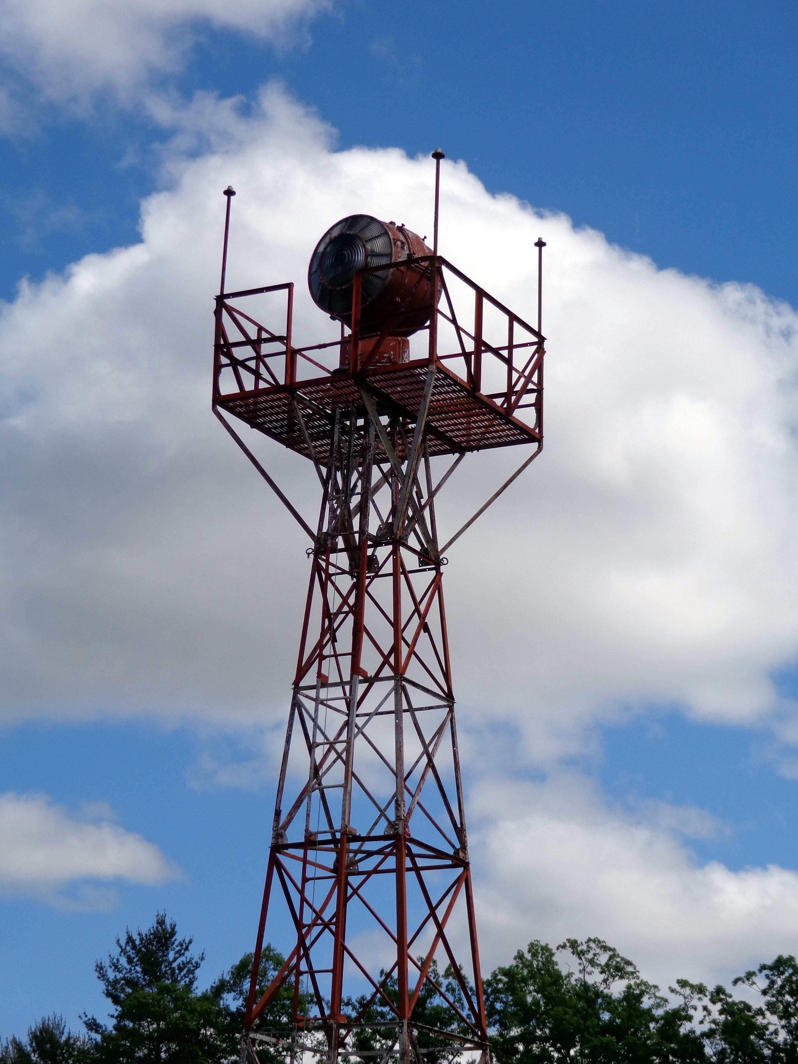
Aircraft Navigational Beacon and Tower on display at the New England Air Museum
Agawam – see Springfield – Bowels-Agawam Airport.
Athol – Orange and Athol Airport, commercial. Located two miles south-east of Orange, 2.5 miles south-west of Athol. Altitude, 550 feet. Four runways, two of them measuring 3,000 feet, and the other two, 2,500 and 2,000 feet respectively. Aircraft service facilities – day only.
Beverly, Beverly Airport, municipal. Located two miles north-west of center of town. Two runways, measuring 1,850 and 1,450 feet. “Beverly” on hangar roof. Hangar and field buildings to the south-east. Aircraft service facilities – day only.
Boston – Boston Airport, municipal. Located 1.5 miles east of the Customhouse tower in center of business district; adjacent to harbor and docks. Altitude, 12 feet. Four runways, one 3,700 feet, the other three, 2,500 feet. 24-inch rotating beacon rotating clear with green auxiliary code beacon, operates all night. 24-hour aircraft service facilities. Seaplane ramp on south-west end of field. Airport is used as the operating base by the Massachusetts National Guard Air Corps Reserves.
Boston – (North Quincy) – Dennison Airport, commercial. Located at the north-east edge of North Quincy, 4 miles airline south of Customhouse Tower in Boston. Altitude, 14 feet. Three runways, 2,030, 1,900, and 1,410 feet in length. “Dennison Airport” on hangar roof. Aircraft service facilities – days only.
Brockton – Brockton Airport, commercial. Located two miles south of center of Brockton on main highway. Altitude, 128 feet. Two gravel runways, 1,00 and 1,400 feet long. Runways are only safe landing area in early spring or exceptionally wet or rainy weather. “Brockton” on hangar roof. Aircraft service facilities – days only.
Brookfield – Brookfield Airport, auxiliary. Located 7/8 of a mile west of Brookfield, 1/4 mile west of cemetery, across street from large barn, state road on north. Altitude, 740 feet. Railroad to the south. No service facilities.

Vintage Post Card View Of
Martha’s Vineyard Airport
Edgartown – Marthas Vineyard Airport, commercial. Located 1.5 miles south of city. Water tower, 100 feet high between city and field. Altitude, 5 feet. “Curtis Wright”, and “Edgartown” on hangars. Aircraft service facilities – day only.
Fairhaven – New Bedford-Fairhaven Airport, commercial. Located 2.5 miles north-east of center, on east bank of Acushnet River; three miles east of New Bedford; three miles north-east of Buzzard’s Bay. Altitude, 17, feet. “Fairhaven-New Bedford” on hangar. 200 foot water tower 3/4 mile to the west. Aircraft service facilities – day only. Airport was dedicated April 19, 1930.
Falmouth – Falmouth Airport, municipal. located three miles east of North Falmouth, five miles east of Buzzard’s Bay; six miles north of Falmouth center. Altitude, 100 feet. “Falmouth, Mass” on hangar roof. Facilities for servicing aircraft day and night during the summer. Coonamessett Lake 1.5 miles to the south of field available for seaplanes in emergency, with gas and oil.
Fitchburg – Fitchburg-Leominster Airport, commercial. Located two miles south-east of Fitchburg; two miles north of Leominster in valley. Altitude, 300 feet. Three runways, measuring 2,800, 2,600, and 1,700, feet. “Fitchburg-Leominster” on hangar roof. Aircraft service facilities – day only.
Framingham – Framingham Airport, commercial. located on eastern side of railroad, one mile south of Framingham. Altitude, 199 feet. Three runways, measuring 2,800, 2,000, and 1,900 feet. “Framingham Airport” on hangar. Aircraft service facilities – day only.
Great Barrington – Berkshire Airways Airport, commercial. located two miles west of town. Altitude, 726 feet. Two runways, measuring 2,000, and 1,700 feet. Aircraft service facilities – day only.
Greenfield – Greenfield Airport, commercial. Located three miles north of Greenfield, railroad to west, Highway No. 5 to the north-east. Altitude, 450 feet. Two runways, measuring 2,200, and 1,700 feet. “Airport” on hangar roof. Aircraft service facilities – day only.
Hanover – Clark Airport, commercial. Located two miles west of city, two miles south-east of Rockland. Altitude, 74 feet. Four runways, measuring 2,100, 1,160, feet, and two at 1,400 feet. Aircraft service facilities – days only.
Haverhill – Haverhill Airport, commercial. Located two miles north-east of Haverhill business district, near Lake Kenosa. Altitude, 125 feet. Aviation fuel available, day only.
Holyoke – see Westfield, Barnes Field.
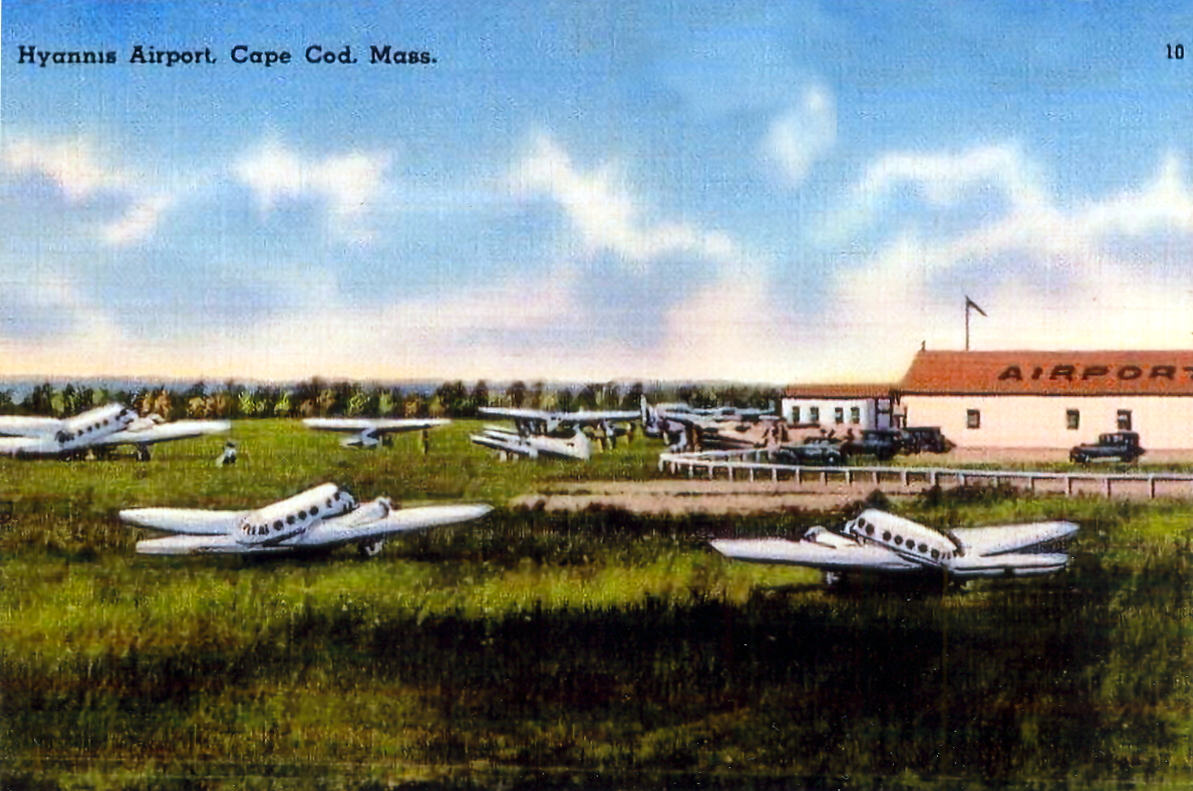
Vintage Post Card View Of Hyannis Airport
Hyannis, Massachusetts – Cape Cod
Hyannis – Hyannis Airport, commercial. Located half-mile north of post office. Altitude, 15 feet. “Hyannis Airport” on hangar. High tension line, buildings, hangar, and grandstand on east side of field. 24-inch rotating beacon, flashing green and white, operated June 15 to September 15, from sunset to midnight. Aircraft service facilities – day only.
Lowell – Lowell Airport, commercial. Located two miles south-east of center of city, on east bank of the Concord River. Altitude, 100 feet. 38 acres in use. “Lowell” on water tower. Tower and building to the south-east. Aircraft service facilities – day only.
Mansfield – Boltz Field, commercial. Located 1.5 miles south of Mansfield. Altitude, 140 feet. Two runways, measuring 1,200 feet. “Mansfield” on barn roof. no service facilities.
Marlboro – Marlboro Airport, commercial. located two miles east of Marlboro; 1/4 mile north of Reservoir No. 5. Altitude, 255 feet. Two runways, measuring 1,650 and 1,350 feet. “Marlboro” on hangar roof. Greenhouses and scattered buildings to the west. Aircraft service facilities – day only.
Medfield – Fairacres Field, auxiliary. Located one mile south-east of Medfield on north side of railroad. Altitude, 160 feet. Four runways, measuring two at 2,100 feet, and the others at 1,100 and 1,000 feet. Orchard to the west. Two radio towers 2.5 miles north-west. No aircraft service facilities.
Mendon – Mendon Airport, commercial. Located 3 mils south-west of Milford; 4 miles north-east of Uxbridge; 10 miles north of Woonsocket, R. I.; Lake Nipmuck 1/2 mile south-west of field. Altitude, 450 feet. Three runways, measuring 1,880, 1,700, and 1,500 feet. “Mendon” embedded in field. Arrow pointing north. 36 inch red and clear rotating beacon. 24 hour aircraft service facilities.
Nantucket – Nobadeer Airport, auxiliary. Located 2.5 miles south-east of Nantucket. Altitude, 15 feet. Two runways, measuring 2,200 and 1,600 feet. Aviation fuel – day only.
Natick – Natick-Wellesley Airport, commercial. Located about 1.2 miles north of Natick. Altitude, 200 feet. Three runways, measuring 2,100, 1,900, and 1,550 feet. Hangars and administration building to the south of field. Aircraft facilities – day only.
North Adams – North Adams Airport, auxiliary. Located 2.5 miles west of North Adams, .5 mile north-west of reservoir, south of state road, railroad, and river. Altitude, 750 feet. No service facilities. Filed soft in spring after heavy rain.
North Hampton – La Fleur Airport, commercial. Located .8 of a mile north-east of city. Altitude, 120 feet. “La Fleur Airport” on side of building.
North Grafton – Grafton Airport, municipal. Located to the south of North Grafton; five miles south-east of Worcester. Altitude, 450 feet. Four runways, measuring 3,000, 2,450, 1,800, and 1,600 feet. Aircraft service facilities – day only.
Norwood – Canton – Boston Metropolitan Airport, commercial. Located two miles east of Norwood, and one mile west of Canton. Altitude, 51 feet. Four gravel runways, two measuring 2,500 feet, and the other two measuring 2,000 feet. “Norwood-Canton” on hangar roof. “Metropolitan Airport” across front of hangar. Flashing amber beacon located 1/2 mile to the north-east of airfield on Gliders Hill, operated from dusk to midnight. Aircraft service facilities – day only.
Pittsfield – Department of Commerce Intermediate Field (day field) Site 3, Albany-New York Airways. Located one mile south of Pittsfield center. Altitude, 1,130 feet. Two runways, 2,600 and 1,800 feet long. Aviation fuel available. Airport was dedicated June 6, 1931.
Revere – Muller Field, commercial. Located one mile north-west of Revere, six miles north-east of Boston post office. Altitude, 30 feet. Two runways, 2,500 and 1,500 feet long. “Muller Field” on hangar. Aircraft service facilities – day only.
Southbridge – Southbridge Field, auxiliary. Located one mile north of town center. Altitude, 50 feet. Two runways, measuring 1,500 and 850 feet. Trees to the east. No service facilities.
South Dartmouth – Round Hill Airport, privately owned. Located three miles south of city on Buzzard’s Bay; six miles from New Bedford Mass. Altitude, 12 feet. “Round Hill Airport” on airship dock. Windmill to the north; 150 ft. radio towers to the north-east; water tower to the south-east; 135 foot radio towers to the south; swamp, and airship dock to the west. Lighthouse 1/3 mile south-east of field. 24-inch green and white rotating beacon, flashing code “D”, (- . . ), also a 20-inch green and white rotating beacon flashing “RH” (. – . ….). 24-hour aircraft service facilities. seaplane anchorage available on south side of field.
Springfield – Bowles-Agawam Airport, commercial. Located five miles south-west of city, about 1.25 miles south-west of Agawam. Altitude, 200 feet. Four runways, measuring 1,000 feet, surrounded by a 2,500 ft. taxi circle, asphalt paved. “Bowles-Agawam, Mass.” neon sign on hangar. Scattered woods and buildings around field, a 1,000 foot hill to the south-west. 24-inch green rotating beacon flashing “BA”, (- … .-) 24-hour hangars, aviation fuel and accomodations.
Springfield – Springfield Airport, commercial. Located 2.5 miles north-east of city. Altitude, 200 feet. “Springfield, Mass. Airport” on hangar, illuminated. Hangars and houses to the north-east. Boundary lights and flood lights. 24-inch clear and green rotating beacon flashing “SA” (. . . .-). 24-hour aircraft service facilities. Radio receiving equipment.

Squantum NAS Seaplanes – 1949
Squantum – Naval Reserve Aviation Base, U.S. Navy owned. Located four miles south-east of Boston on edge of harbor. Altitude, sea level. Two runways measuring 1,600 and 1,300 feet. Large buildings to the east. Tower four miles to the north-west, lighted by revolving beacon. radio tower 1/2 mile to the east – lighted. Seaplane facilities in Dorchester Bay. Small boats ramp and hangar available. Aircraft service facilities available for government planes only, daytime hour only. Naval radio station NAG, operating frequency 545 kc.
Taunton – King Field, commercial. Located four miles east of city; south of river; east of two large mills. Altitude, 45 feet. One runway, 3, 650 feet long. 24-hour aircraft service facilities.
Turners Falls – Franklin Airport, commercial. 1.75 miles south-east, on the east bank of the Connecticut River; 3.5 miles east of greenfield, Mass. Altitude, 345 feet. “Franklin Airport” on hangar. Aviation fuel in summer only.
West Barnstable – Cape Cod Airport, commercial. Located two miles south-west of town center. Altitude, 100 feet. Facilities for servicing aircraft – day only.
Westboro – Turnpike Airport, commercial. Located two miles north-west of Westboro; 7.5 miles east of Worcester; five miles south-west of Marlboro. Altitude, 310 feet. Pond to the south. Aircraft service facilities – day only.
Westfield-Holyoke – Barnes Airport, municipal. Located two miles north-east of Westfield, 4 miles south-west of Holyoke. Altitude, 280 feet. Facilities for aircraft service – day only.
Westwood – Westwood Airport, commercial. located 1.5 miles south-west of Westwood; two miles north-west of Norwood; five miles south-west of Dedham. Altitude, 190 feet. Three runways, measuring 1,400, 1,200, and 1,230 feet. Aircraft service facilities – day only.
Winchendon – Winchendon Airport, auxiliary. located five miles south-west of Winchendon; on east side of Route No. 32. Altitude, 860 feet. Two runways, measuring 1,650, and 1,450 feet. Hangar and aviation fuel – day only.
NEW HAMPSHIRE

1930s Post Card View Of The
Claremont, New Hampshire, Airport.
Berlin – Berlin Airport, municipal owned. Located four miles north of Berlin. Altitude, 1,100 feet. One runway, 2,000 feet long. One hangar. Aviation fuel – day only.
Claremont – Claremont Airport, municipal owned. Located one mile due west of Claremont. Altitude, 520 feet. “Claremont Airport” on hangar roof. Ski jump tower to the east of field. Aircraft service facilities – day only.
Concord – Concord Airport, municipal owned. Located one mile east of Concord. Altitude, 335 feet. “Concord Airport Corporation” on hangar. 24-hour aircraft service facilities.
Conway – Conway Airport, auxiliary. Located 1/4 mile north of Conway, on Highway No. 18. Altitude, 500 feet. Aviation fuel and minor repairs – day only – only during the summer months.
Deerfield – Hilton Field, auxiliary. Located one mile north-west of Pautuckaway Mountains, 2 miles south of Deerfield post office. Altitude, 575 feet. Buildings to the west, brush to the north and east, garden to the south. No service facilities.
Freedom – Freedom Field, auxiliary. Located .5 mile south-west from center of town. Altitude, 600 feet. “freedom” on nearby building. Stone wall on west and north side of field,; barn and rocks to the north-east. No service facilities.
Gorham – Gorham Field, auxiliary. Located three miles north on west bank of Andrascoggin River. Altitude, 830 feet. Hangars. No service facilities.
Keene – Keene Airport, commercial. Located 2.5 miles north-west of center of keene. Altitude, 500 feet. Two runways, 2,000 and 1,200 feet long. “Keene” on hangar roof. Hill to south-east. Aircraft service facilities – day only.
Lisbon – Corbleigh Airport, auxiliary. Located one mile north-east of Lisbon on cement highway. Altitude. 600 feet. Aviation fuel only.

1930s Post Card View Of
Concord, New Hampshire, Airport.
Manchester – Manchester Airport, municipal. Located four miles south-east of center of city. Altitude, 220 feet. Three runways, 2,500 and 2,000 feet long. Aircraft service facilities – day only.
Marlow – Keith Flying Field, privately owned. Located three miles north-west of Marlow between two ponds; midway between Keene and Claremont, and Keene and Newport. Altitude, 1,500 feet. One runway, 1,500 feet long. Stone walls to the north and south of field. No service facilities.
Newport – Albert N. Parlin Field, auxiliary. Located 1.5 miles north of Newport center on east bank of Sugar River, and west of Colt Mountain. Altitude, 800 feet. Two runways, measuring 3,000 and 1,800 feet. “Newport, N.H.” on hangar roof. Hangar mechanic and aviation fuel, days only.
North Conway – White Mountain Airport, commercial. Located three miles north of town center between highway and railroad. Altitude, 500 feet. One runway, 1,800 feet long. Aircraft service facilities – day only.
Plymouth – Plymouth Airport, commercial. Located three miles south-east of city, just east of Pemigewasset River. Altitude, 470 feet. Aviation fuel – day only.
Portsmouth – Lafayette Airport, commercial. located 1.4 miles south-west of city on Lafayette Road. Altitude, 25 feet. Hangar building. Marsh and creek to the east. Aircraft service facilities – days only.
Twin Mountain – Twin Mountain Airport, auxiliary. Within city limits, .5 mile south of post office on U. S. highway No. 3. Altitude, 1,495 feet. One runway, 2,000 feet long. Mechanic, aviation fuel – day only.
Whitefield – Whitefield Airport, auxiliary. Located 2.5 miles east of town center. Altitude, 1,000 feet. No services.
Winchester – Winchester Airport, auxiliary. Located one mile south-east of city; five miles east of Connecticut River. Altitude, 490 feet. One runway, 1,900 feet long. No aircraft facilities.
RHODE ISLAND

Vintage Hillsgrove Airport Postcard.
Today known as T.F. Green State Airport – Warwick, R.I.
Middletown/Newport – Newport Airport, commercial. Located 3.3 miles north of city. Altitude, 85 feet. “Newport Airport” on hangar. Limited repair facilities, aviation fuel – day only. (Airport is actually located in Middletown, R.I.)
Newport – Seaplane base, U. S. Naval Air Depot. Located 2 miles west of Newport Airport, on Gould Island in Narragansett Bay. Runway available for taxing amphibians to ramp. Buoy available for mooring seaplanes. Magazine on east side of island filled with high explosives. Aviation fuel and service on emergency basis only.
North Smithfield – Montgomery Field. Located off Mendon Road near the Woonsocket city line. Altitude, 162 feet. Two runways, measuring 1,700 feet, and 1,400 feet. “Woonsocket” on hangar roof, but airport was in town of North Smithfield. Hangar measured 50 by 60 feet. Aviation fuel, oil, repairs, and telephone available.
Pawtucket – What Cheer Airport, commercial. Located 5.5 miles north of the Biltmore Hotel in downtown Providence, on land between Manton St. and Newport Avenue in the city of Pawtucket, extending into the neighboring city of East Providence. Three runways, measuring 3,200, 3,000, and 2,600 feet. 60 by 60 ft. hangar, with name of airport illuminated on front. (What Cheer Airport closed in 1934.)
Providence – Providence Airport, commercial. Located six miles south-east from center of city. (Airport was actually located in the town of Seekonk, Massachusetts.) Altitude, 25, feet. “Providence Airport” on hangar. Aircraft service facilities – days only.
South Kingstown/Quonset Point – State Camp grounds, auxiliary. Located 3.5 miles from village of Wickford, R.I.. Altitude, 10 feet. No service facilities. Became a major naval base during WWII.
The original hangar at the Smithfield R.I. Airport which opened in 1932. Bryant University now occupies this land.
Smithfield – Smithfield Airport, commercial. Was located in the area where the football stadium is at present-day Bryant University. Two runways, 2,000 and 1,500 feet long. “Smithfield Airport” on hangar. Aircraft service facilities – day only. Altitude, 580 feet.
Tiverton – Miltex Field, privately owned. Located two miles south-east of Fall River, Mass. Altitude, 250 feet. Landing area flood lights. Hangar and fuel open during the day.
Warwick – Buttonwoods Field, auxiliary. Located on Greenwich Bay in Buttonwoods section of the city. Altitude, 10 feet. Open for seaplanes. No service facilities.
Warwick – Hillsgrove Airport – owned by state of R.I. Is today known as T.F. Green Airport. (The main airport in the state.)
Westerly – Atlantic Airport, commercial. Located 9 miles east of downtown Westerly. Name and wind-cone on 40 by 60 foot hangar. Aircraft service facilities – day only.
Woonsocket – Woonsocket Airport, auxiliary. Located 2 miles north-east of center of downtown Woonsocket. Altitude, 400 feet. Four runways, measuring 2,400, 2,000, 1,800, and 1,500 feet long. “Woonsocket Airport” on hangar. No aircraft service facilities.
VERMONT
Old Postcard View Of Burlington Airport
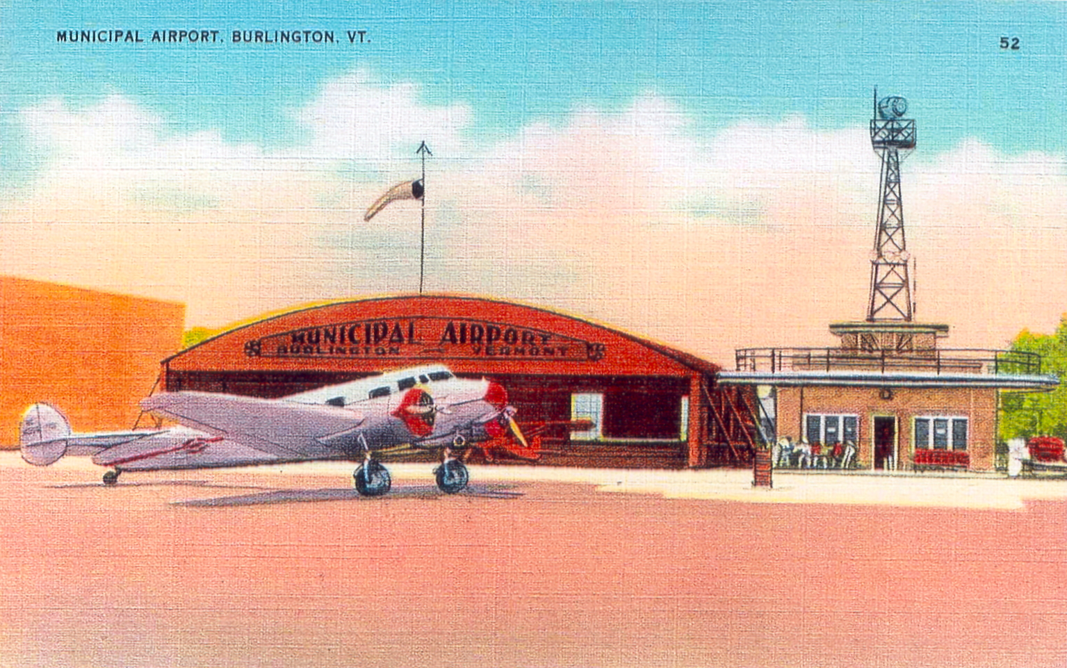
Burlington – Burlington Airport, municipal. “Burlington” on hangar. Two runways, both 4,000 feet long. 24-hour aircraft service facilities.
Forth Ethan Allen – Fort Ethan Allen Field, owned by U. S. Army. Located five miles north-east of Burlington. Altitude, 200 feet. “Fort Ethan Allen” on roof of building. Radio towers to the north-east and buildings around field. No aircraft service facilities. Radio communication station operated by the army, WUX, operating on frequency of 200kc.
Manchester – Equinox Airport, commercial. Located one mile east; and .5 mile north of lumber mill; 1/4 mile east of Rutland Railroad and Battenki River; east of Equinox Mountain. Altitude, 700 feet. One runway, 1,600 feet long. “Manchester Airport” on field. Aircraft service facilities – day only.
Middlebury – Middlebury Airport, auxiliary. Located 2.5 miles south-east of town center. Altitude, 336 feet. One runway, 1,750 feet long. No aircraft service facilities.
Milton – Schill Airport, commercial. Located 2 miles south-west of center of town. Two runways, measuring 1,600 and 1,550 feet. “Schill Airport” on hangar. Aircraft service facilities – day only.
Montpelier – Barre-Montpelier Airport, commercial. Located four miles south of Montpelier; three miles west of Barre. Altitude, 1,100 feet. “Barre-Montpelier” on hangar roof. Aircraft service facilities – day only.
Rutland – Rutland City Airport, commercial. Located 3/4 of a mile south-west of city; Otter Creek to the east. Altitude, 600 feet. Two grass runways, measuring 1,600 and 1,500 feet. “Rutland City Airport” on building. Hangar and aviation fuel – day only.
Springfield – Hartness Airport, municipal. Located four miles north-west of North Springfield, and half-way on compass course between Boston, mass., and Burlington, Vermont. Altitude, 600 feet. Five runways, measuring 1,660, 1,170, 1,616, 1,325, and 1,200 feet. “Springfield, Vermont” on hangar. Hangar and aviation fuel – day only.
Swanton – Missiquoi Airport, municipal. (Temporary air port of entry) Located one and one-eighth miles north-east of Swanton. Altitude, 300 feet. Two gravel runways, each measuring 2,000 feet long. “M” embedded in circle on field. Aircraft service facilities – day only.
White River Junction – Twin State Airport, commercial. Located one mile south-west of White River Junction. Altitude, 400 feet. Two runways, measuring 2,000 and 1,500 feet. “Twin State Airport” on hangar roof. Aircraft service facilities – day only.
Rhode Island Airport Locations – 1932
Below is a list of active airports in the state of Rhode Island in 1932, according to a state highway map issued by the state. All but two of them are now defunct. Those still in use are #5, Rhode Island State Airport, (Today known as T. F. Green Airport), and #9, Newport Airport, in Middletown, R.I.
#4 was called the Providence Airport, but it was actually located in Seekonk, Massachusetts.
Absent from this list is the Smithfield Airport, which was located on property now occupied by Bryant University, and RICON Airport, located in Coventry, Rhode Island, near the Connecticut boarder. (RICON Airport is still in use.)
Click on images to enlarge.
Once the image is brought up, click on it again to supersize it.

The original hangar at the Smithfield R.I. Airport which opened in 1932. Bryant University now occupies this land.

RICON Airport original Hangar, Coventry, Rhode Island

1930 Map Of The Providence Airport in Seekonk, Massachusetts.
Vintage Hillsgrove Airport Postcard.
Today known as T.F. Green State Airport – Warwick, R.I.
Smithfield Airport, Smithfield, Rhode Island – August 25, 1940
On August 25, 1940, Stanley G. Smith, 21, of Woonsocket, crashed while practicing take-offs and landings at the Smithfield Airport. His aircraft landed upside-down in an apple orchard about 275 yards from the end of the grass runway. The plane, a 1937 Continental Cub Monoplane (NC-20012) was a total wreck, but fortunately Smith escaped with only minor injuries. Undaunted by his brush with death, he climbed into another airplane and flew again a few minutes later!
The former Smithfield Airport was located where Bryant University stands today. The runway was located near the present-day football stadium. The airport opened in 1932, and remained in operation into the 1950s, and should not be confused with present-day North Central State Airport, which is located in Smithfield, R. I., and is sometimes referred to as the Smithfield Airport.
Source:
Woonsocket Call, “Woonsocket Flier Escapes Serious Injury As Plane Crashes Near Smithfield Airport.” August 26, 1940
Smithfield Airport – May 17, 1947
Smithfield, Rhode Island
On May 17, 1947, a 34-year-old pilot from Cranston suffered critical injuries when he undershot the grass runway at the Smithfield Airport and crashed his WWII surplus monoplane through a stone wall after which it flipped onto its back. He was transported to Roger Williams Hospital in Providence.
The aircraft was a Ryan PT-22 low wing monoplane.
The Smithfield Airport opened in 1932, and once occupied the land now owned by Bryant University. The airfield was located where the Bryant football stadium stands today. Smithfield Airport no longer exists, and should not be confused with North Central State Airport, which is still an active airport in the town of Smithfield, Rhode Island.
Sources:
Woonsocket Call, “Men Escape Without Injuries As Plane Crashes In Cumberland”, May 26, 1947. This article focused on a plane crash in Cumberland, R. I. which occurred on May 25, 1947, but mentioned that the Cumberland accident was the third aviation accident for the month of May in Rhode Island. One of the other two accidents mentioned was the one in Smithfield at the Smithfield Airport on May 17th.
Pawtucket Times, “Trio Unhurt In Plane Crash”, May 26, 1947. Article tells of another plane that crashed in Cumberland, as well as the Smithfield accident.